Friday, October 29, 2010

Mount Andromeda

Located between Athabasca Glacier and Saskatchewan Glacier on the border of Banff & Jasper parks, Alberta Major headwaters Athabasca & Saskatchewan rivers, Mount Andromeda is located within the Columbia Icefield. The mountain can be seen from the Icefields Parkway (#93) near Sunwapta Pass and is directly southwest of Mount Athabasca. This peak has two summits, the southwest and northeast. Although older guidebooks said they were approximately equal height, BC Basemap clearly shows that the Northeast summit has one more 20m contour line. This summit has many technical snow and ice routes. All routes to the summit are exposed and subjected to considerable rockfall or avalanche danger. 
Mt. Andromeda was named in 1938 by Rex Gibson, former president of the Alpine Club of Canada, after Andromeda, the wife of Perseus.

Athabasca Glacier

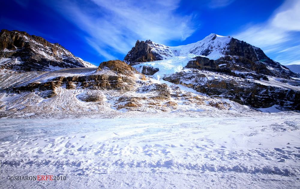
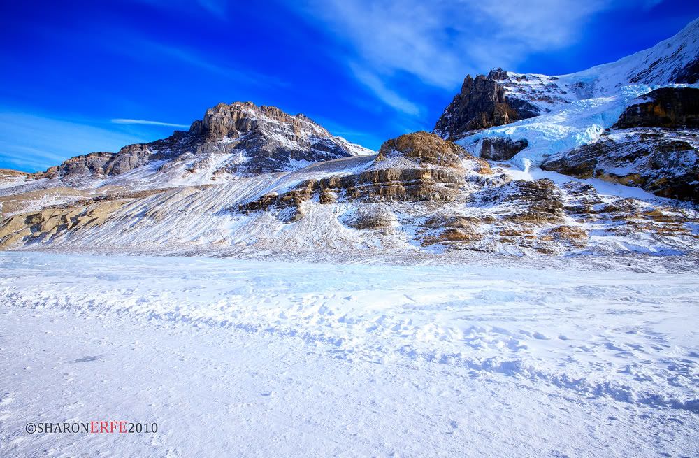
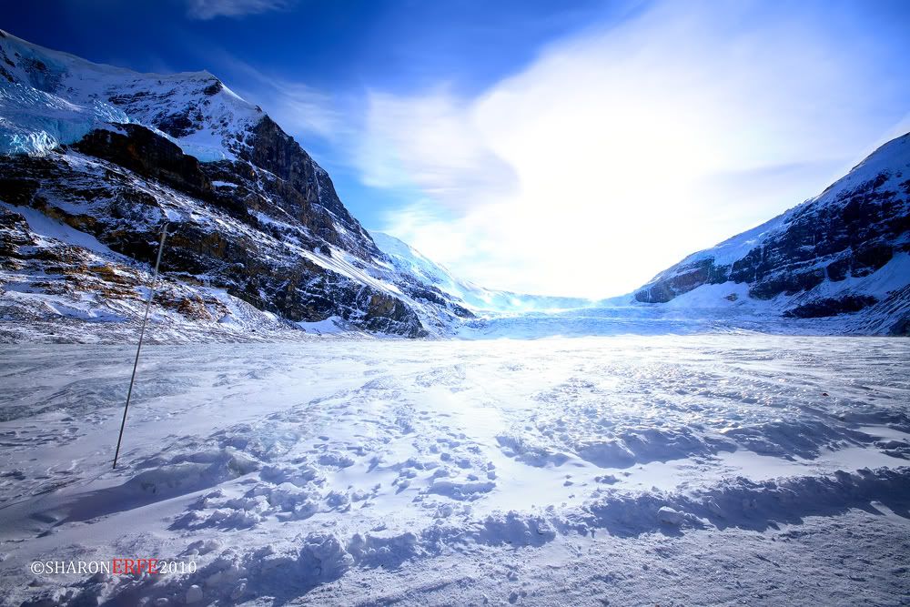
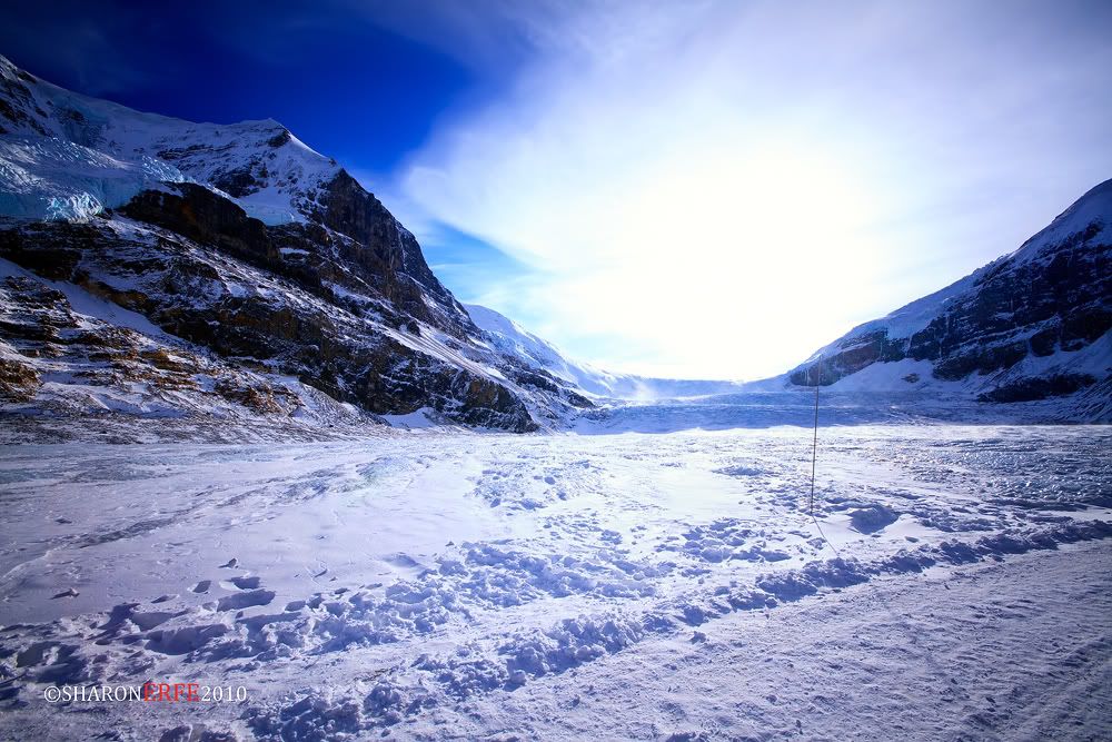
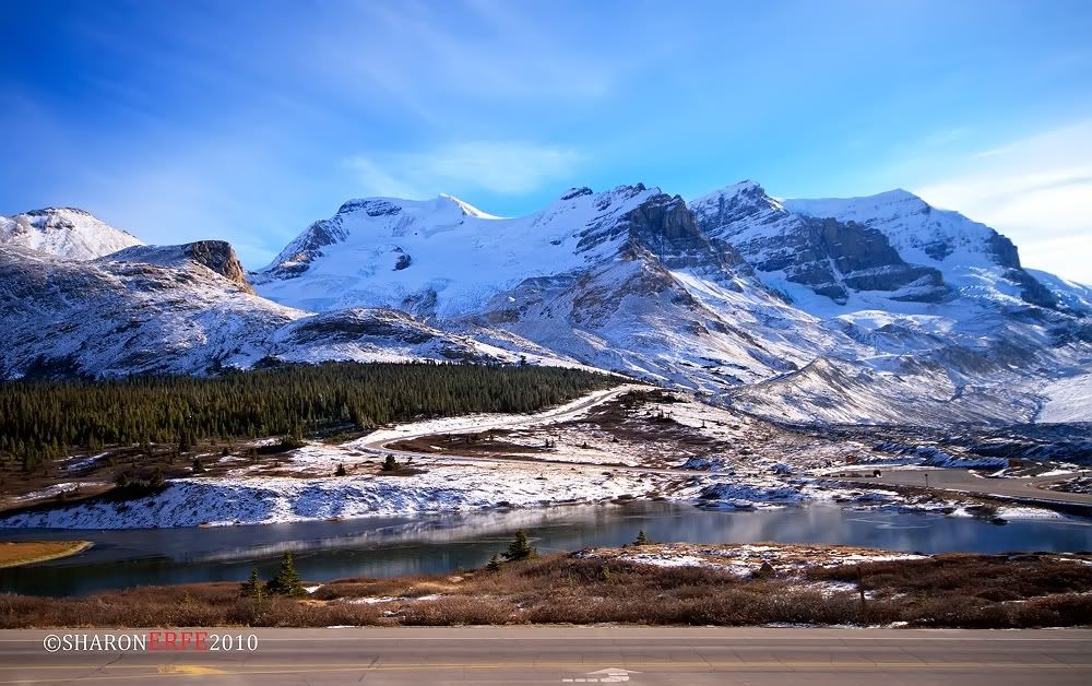
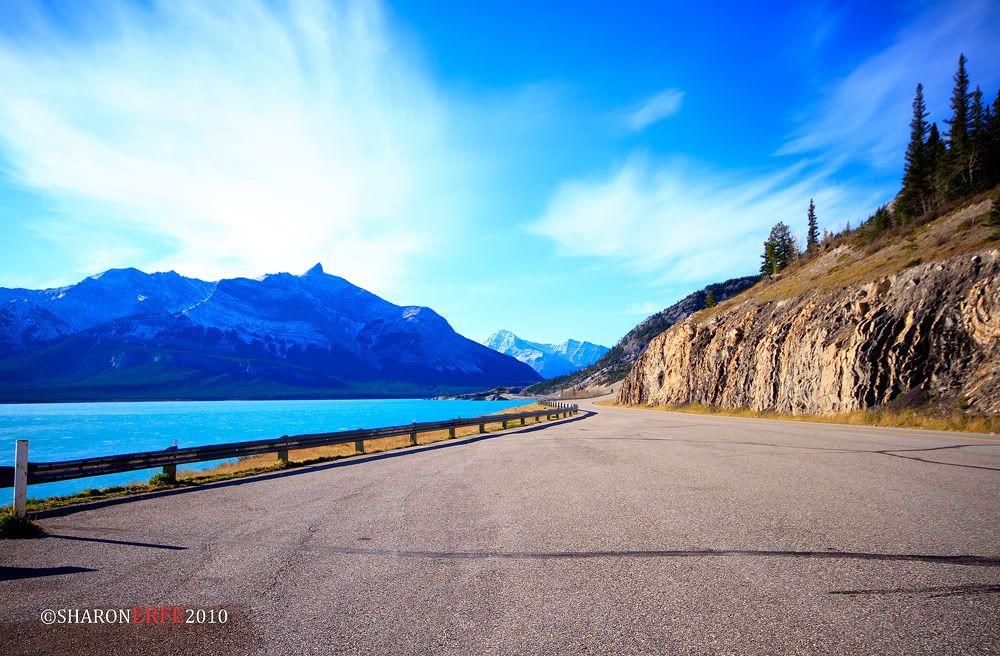
The Athabasca Glacier is one of the six principal 'toes' of the Columbia Icefield, located in the Canadian Rockies. The glacier currently recedes at a rate of 2-3 metres per year and has receded more than 1.5 km in the past 125 years and lost over half of its volume. The glacier moves down from the icefield at a rate of several centimetres per day. Due to its close proximity to the Icefields Parkway, between the Alberta towns of Banff and Jasper, and rather easy accessibility, it is the most visited glacier in North America. The leading edge of the glacier is within easy walking distance; however, travel onto the glacier is not recommended unless properly equipped. Hidden crevasses have led to the deaths of unprepared tourists.

The Icefield Interpretive Centre, closed during the winter (mid-October to mid-April), stands across from the glacier. It is used as a lodge and for ticket sales for sightseeing on the glacier. Standard buses transport tourists to the glacier edge, where they board specially designed snow coaches for transport over the steep grades, snow and ice part way up the glacier.
The glacier is approximately 6 km (3.75 miles) long, covers an area of 6 km² (2.5 mi²), and is measured to be between 90 metres (270 ft) and 300 metres (1000 ft) thick.

Some cold hard facts
* It is 6 km squared in area.
* It is 6km long.
* Its depth is 90-300m (270 – 1000 feet) – The ice is as thick as the Eiffel Tower is high.
* It has icefall movement of 125m / year (400ft)
* It has turn around movement of 25m/year (80 ft)
* The icefalls elevation is 2700m (8900ft)

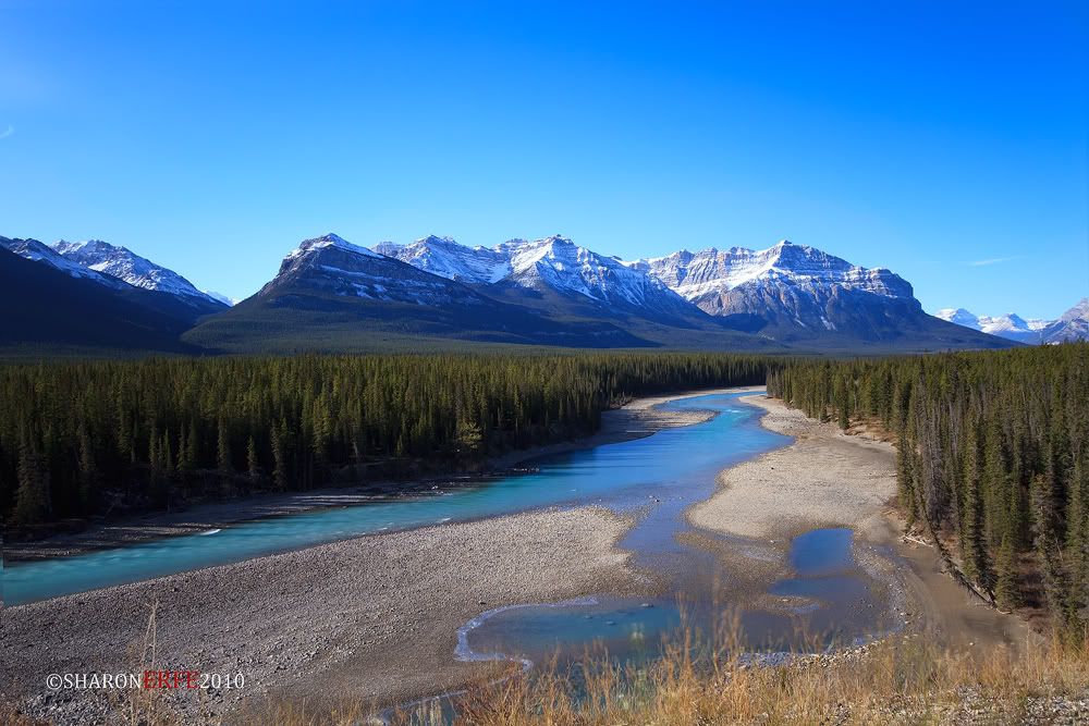
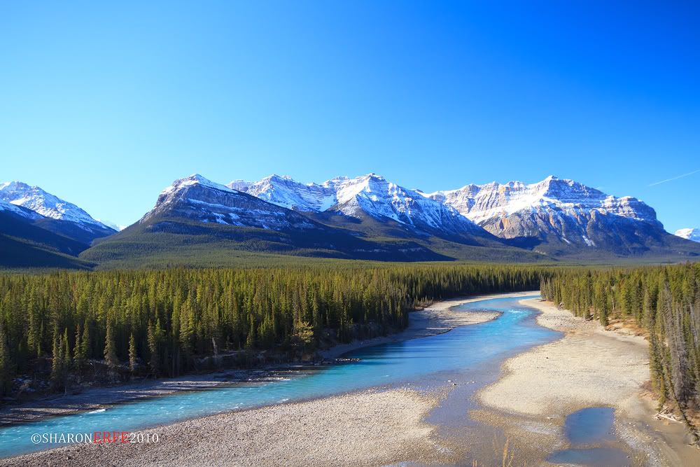
Once, the Athabasca Glacier flowed north to the present site of Jasper before joining other glaciers and cruising south east past Calgary. This journey, much like trying to get through Vancouver in rush hour, took many centuries. The Athabasca is slowly flowing downhill from the Columbia Icefields similar to the flow of a river.

Thursday, October 28, 2010

Columbia Icefield


Midway between Jasper and Banff is one of the most popular attractions in Western Canada.

Athabasca Glacier is part of the masssive Columbia Icefields which are a vast reservoir of ancient water. The Icefields are the source of the headwaters of three rivers that flow to three different oceans (Arctic, Pacific and Atlantic). Nowhere else on Earth can you find such a phenomenon.

As the glaciers melt they are also sliding down the mountain sides and as they do so are crushing vast amounts of prehistoric rock into a fine powder, called rock flour. This powder floats into nearby lakes and rivers. It becomes suspended in the water and reflects light to our eager eyes. The colors are stunning and are different shades of blue, green and grey. Colors vary at different times of day and from lake to lake. It is a remarkable display that nature puts on for lucky travelers to the Canadian Rocky Mountains. 
Some cold hard facts. 
It covers 325km squared – making it comfortably the largest body of ice in the Rocky Mountains
* Its highest point is Mt. Columbia at 3745 m (12,284ft)
* The average elevation is 3000m (10,000 ft)
* The greatest estimated depth is 365m (1200 ft)
* The average snowfall is 7m (23 ft) every year.
* Uniquely it drains into the Pacific, Arctic and Atlantic Oceans.
The Columbia Icefields are considered one of the largest accumulations of ice and snow south of the Arctic Circle, and can reach depths of 2,000 feet. 

Wednesday, October 27, 2010

Rock and Colors


A view on highway AB 93 South on way to Jasper National Park, combining the chaste color of the rockies and plush shade of autumn. Artlessly A-OK!!! =)

Fall Driving


Driving to a beautiful scenery as this, who wouldn't FALL?! =)

Tuesday, October 26, 2010

Lost Paradise


An empty space filled with beauty and grace. A lost paradise waiting to be captured. =)

Long Drive (Cross-Province)


Drove 8.5 hours from Yorkton, Saskatchewan to Edmonton, Alberta. From there, it took 3 to 4 more hours to go all the way to Jasper. This was our first stop - over from Edmonton to Jasper. The view is breathtaking. One of the longest and best road I've ever driven on so far. :)

Surrounding the area are the Rockies which would make your hours of driving amazingly incredible. You'll definitely be in awe of God's creation. Absolutely a must-do on summer time. =)

Monday, October 25, 2010

Canadian Rockies


This is what Canada is famous for, the Canadian Rockies. :) Drove 8.5 hours from Yorkton, Saskatchewan to Edmonton, Alberta. From there we had to drive 3 - 4 more hours to go to the Jasper. On the way would be all these Rockies that would make all the driving worthwhile. :) It is indeed the best long drive I ever had and I would definitely come back next year. The temperature around that time was between +4 to +8, almost ready for winter, but if you would dress up in layer, this wouldn't be too much of a problem. So now, let's enjoy The Rockies =D


The Canadian Rockies comprise the Canadian segment of the North American Rocky Mountains range. They are the eastern part of the Canadian Cordillera, extending from the Interior Plains of Alberta to the Rocky Mountain Trench of British Columbia. The southern end borders Idaho and Montana of the USA. The northern end is at the Liard River in northern British Columbia.
The Canadian Rockies have numerous high peaks and ranges, such as Mount Robson (3,954 metres (12,972 ft)) and Mount Columbia (3,747 metres (12,293 ft)). The Canadian Rockies are composed of shale and limestone (unlike their American cousins). Much of the range is protected by parks and a World Heritage Site.

The Afterglow


An afterglow is a broad high arch of whitish or rosy light appearing in the sky due to very fine particles of dust suspended in the high regions of the atmosphere. An afterglow may appear above the highest clouds in the hour of deepening twilight, or reflected from the high snowfields in mountain regions long after sunset. The particles produce a scattering effect upon the component parts of white light.

Taken in York Lake, Saskatchewan. This might be one of the few shots that I have left for Fall season as it is now beginning to get freezy getting ready for winter.

Saturday, October 23, 2010

Don't FALL


Title speaks for itself :)

Loboc Church


The Church of San Pedro in Loboc is the second oldest church in Bohol. It was originally built in 1602, but soon reduced to ashes. In 1638, a stronger one was build. Located near the river, it has survived a number of floods. Inside the church, you can admire some remarkable naive paintings on the ceiling. A Spanish coat of arms can be found in the stone wall near the entrance of the convent. The bell tower of Loboc is about 100 meters from the church.


Friday, October 22, 2010

How do you FALL?


How do you FALL? Slowly..? Fast..? Deep..? Insane..?
For this tree, he FALLS from green to orange to yellow. :)

Thursday, October 21, 2010

His Imminent Grace


Crescent Lake, Saltcoats Saskatchewan. You wil never get tired of taking it's photo especially on fall. :)
The leaves are yellow, the water is blue, and the sky is just a reflection of God's imminent grace. :)

Wednesday, October 20, 2010

Sisiman Bay Lighthouse


This photo taken in Sisiman Bay, Mariveles Bataan was one of the last few shots I took during my vacation home this year 2010. With almost 3 hours of travel from Manila, I met up with a new found friend to guide us in our travel to Brgy. Sisiman to this abandoned lighthouse. This place is very famous to every Filipino landscape photographer there is and there is no way I could let time passed by without taking some beautiful coastalscape shots. :) Taken with 30 seconds exposure using an ND400 filter. I stayed there from 11am till about after sunset. It was indeed a magnificent sweep of God's power. :)

Special thanks to Nina Escaler and to her friend Mr. Eric Sioson for making this shot possible.. :)


Monday, October 18, 2010

Lakeshore


This is another shot I took of the Crescent Lake giving emphasis on the trees. Using an ND8 filter, if I remember it correctly, with exposure of 3.2 seconds. Enjoy :)

Saturday, October 16, 2010

Breaking Dawn


Taken around 15km east of Yorkton, breaking dawn represents a promise of a new day. Surrounded by darkness, the light just keeps pushing himself in. :) It is recognized by the presence of weak sunlight, while the sun itself is still below the horizon. Either way, we could expect the sun to still come out and overcome darkness. 

Friday, October 15, 2010

"Hopeful"


Entitled "Hopeful" as how my friend defines it. Taken in Crescent Lake, Saltcoats, Canada. This photo is dedicated to a friend of mine who needs all the hope life could offer. Enjoy! :)

Punta Cruz Watch Tower


In Maribojoc, some 14 km west of Tagbilaran City, a curious triangular watch tower oversees the seas South of Bohol. From its windows at the top, you can see Cebu, Siquijor, and Mindanao. The Spanish had it build in 1796 as a look-out post against pirates and Muslim marauders, who at that time where a plague to the people of Bohol.

Thursday, October 14, 2010

A Typical "Fall" Day


This is a typical morning in Saltcoats during fall season. This was around 9am, temperature is about +10 to 15 degree celsius. Leaves are yellow to orange, if not falling off. Such a sight to notice even when you were just walking down the street. A scene most often taken for granted once you get used to it.  Still, a panorama of God's creation.

Wednesday, October 13, 2010

Saskatchewan's Sunset


Taken in York Lake Yorkton, Saskatchewan. Don't you just wish you were here to witnessed this for yourself? A very hopeful moment at the most down side of the day, the Saskatchewan sunset. It's not really my first time to capture Canada's sunset, however, this became a meaningful one representing the stage I am in in my life.. Optimistic amidst life's storm.. Nobody could break me, for even in life's darkness, there is always and always something that keeps me together. And I am pertaining to that One GOD that holds every detail of my life in His hand. :)

Tuesday, October 12, 2010

Bench


Another shot I took one early morning in Crescent Lake Saltcoats, Canada. This bench may represent emptiness as how my friend looks at it, but for me, this bench defines opportunity. The sight is breathtaking, the weather is perfect, and this bench is ready to take any chances. It's a whole new beginning, it just depends on the person to take this chance and make good use of the blessings surrounding him.

Endless Possibilities


This is another shot of the Pacific Ocean taken from the top of the Watch Tower in Maribojoc, Bohol. Behind the leaves open to endless possibilities, it's up for you what to do with them. God has been so gracious to give us the gift of life, talent, power, love, etc. It's a life full of blessings and we ought to take a hold of it. And for all these, we thank You, Lord. :)

Monday, October 11, 2010

Magellan’s Obelisk


Dedicated to my Cebuano friends who haven't been home for quite awhile now. There were just few photos I took in Cebu since we never stayed there for a long time, and this is one of them. 
Mactan Shrine was built in honor of Lapu – lapu, Magellan and to remember the Battle of Mactan. Built at the center of the shrine is the obelisk depicting Magellan and Spain.

"Sandugo"


Taken first thing in the morning when the sky is perfect blue and the temperature was about +40. It was a good introduction to the rest of the tour we had that day in Bohol.

The Sandugo was a blood compact, performed in the island of Bohol in the Philippines, between the Spanish explorer Miguel López de Legazpi and Datu Sikatuna the chieftain of Bohol on March 16, 1565, to seal their friendship as part of the tribal tradition. This is considered as the first treaty of friendship between the Spaniards and Filipinos. "Sandugo" is a Visayan word which means "one blood".

Saturday, October 9, 2010

Church of San Pedro, Loboc, Bohol

The Church of San Pedro in Loboc, Bohol is the second oldest church in Bohol. It was originally built in 1602, but soon reduced to ashes. In 1638, a stronger one was build. Located near the river, it has survived a number of floods. A Spanish coat of arms can be found in the stone wall near the entrance of the convent. The bell tower of Loboc is about 100 meters from the church. Attached to the building is a three storey convent, which today houses the Museo de Loboc on the third floor.

A Sight to Behold


This is one of the few photos I took of the Mt. Pinatubo Crater. An hour 4x4 ride to drop-off point and a 3 kilometer trek to the crater. Truly a sight to behold. :)

Thursday, October 7, 2010

Waiting on Sunrise

To seize thy beauty everyday is becoming more like breathing. It is natural. There is nothing more I wished for, than to find ourselves together sitting on this bench waiting on sunrise. :)

Taken at Crescent Lake, Saltcoats Canada.

Wednesday, October 6, 2010

Let's FALL.. :)

Fall is L♥VE, let's FALL :)
This photo marks the day I would start shooting for autumn. The leaves might have fallen off already, but there is always and always something to capture and put into stillness. Canada being one of the three regions where colored autumn foliage is famously noted, thus fall becomes my favourite temperate season. :) 
For me, FALL utters L♥VE, so let's FALL. :)

Tuesday, October 5, 2010

AMWAR in IR


This was another IR shot of the Manila American Cemetery and Memorial. Being post-processed differently than the previous ones, I like this one better. Having the sky bluer and the trees more golden yellow.

Monday, October 4, 2010

The Colors of Quietude


This is another photo I took of the sun setting in at Sisiman Bay, Bataan. I finally achieved the effect that I have been wanting to see with my seascape. Using an ND400 with 25 seconds exposure. My long travel has paid off. Truly, sunset is one of the setting I would never get tired of putting on frame. =)

Sunday, October 3, 2010

Dauis Church, Bohol


Another beautiful church in Bohol is the Church of Our Lady of the Assumption in Dauis, Bohol, on the Island of Panglao. It is located not far from the bridge that connects Panglao with Bohol. The church is built in a mixture of styles, influenced by both Byzantine and Romanesque architecture.This is one of Bohol’s beautiful churches, which has retained its Spanish architecture although it has a semi-modern facade. The church is a nice three kilometer walk from Tagbilaran City.

Saturday, October 2, 2010

LIFE in Monochrome


Taken in IR shot, however I can't seem to let it come out the way I want it to so I decided to put it on monochrome. Apparently, it turned out on its best. :) Must be its way of saying, "just let me be me, and you will see life in its fullness." The Life that the tree is expressing was my favorite part of this picture.

Uploaded while in Vancouver Airport waiting for my flight going back to Yorkton. :)

Friday, October 1, 2010

Ang Huling Takipsilim


Ang Huling Takipsilim, taken in Sisiman Bay, Mariveles, Bataan. Dedicated to the last Philippine sunset I had captured from my trip back home this 2010. Having to work in a foreign land where snow is imminent more than any sunshine ever could, this is surely one of the moment I would miss seeing and capturing. Till we meet again.. :)

Manila Cathedral


This was me weeks ago, experimenting with architectural photography with my newly purchased ultra-wide angle lens. :) A shot of Manila Cathedral in Intramuros.